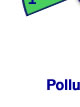
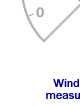
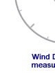
| Data Summary The data are presented in graphical form based on the highest pollutant measured at each site. The air pollution is categorised as LOW, MODERATE, HIGH or VERY HIGH by comparison with the National Air Pollution Index and Banding System. |
| Slough Town Centre Wellington Street - Updated 18/05/2025 07:00 | |
|
|
|
|
||||||||||||||||||||||||||||||||||||||||||||||||||||||||||||||||||||||||||||||||||||||||||||||||||||||||||||||||||||||||||||||||||||||||||||||||||||||||||||||||||||||||||||||||||||||||||||||||||||||||||||||||||||||||||||||||||||||||||||||||||||||||||||||||||||||||||||||||||||||||||||||||||||||||||||||||||||||||||||||||||||||||||||||||||||||||||||||||
| Slough Brands Hill London Road - Updated 18/05/2025 07:00 | |
|
|
|
|
||||||||||||||||||||||||||||||||||||||||||||||||||||||||||||||||||||||||||||||||||||||||||||||||||||||||||||||||||||||||||||||||||||||||||||||||||||||||||||||||||||||||||||||||||||||||||||||||||||||||||||||||||||||||||||||||||||||||||||||||||||||||||||||||||||||||||||||||||||||||
| Slough Windmill Bath Road - Updated 18/05/2025 07:00 | |
|
|
|
|
||||||||||||||||||||||||||||||||||||||||||||||||||||||||||||||||||||||||||||||||||||||||||||||||||||||||||||||||||||||||||||||||||||||||||||||||||||||||||||||||||||||||||||||||||||||||||||||||||||||||||||||||
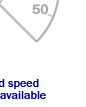
| Slough Lakeside 2 - Updated 18/05/2025 07:00 | |
|
|
|
|
||||||||||||||||||||||||||||||||||||||||||||||||||||||||||||||||||||||||||||||||||||||||||||||||||||||||||||||||||||||||||||||||||||||||
| Slough Lakeside 2 Osiris - Updated 18/05/2025 07:00 | |
|
|
|
|